I admit flying into unfamiliar airports was a high point of anxiety and confusion for me. Part of the reason was not being familiar enough with the surrounding landscape because the rendering on airport charts never quite did the job. In some cases, while approaching a new airport under visual flight rules, I would find myself behind the airplane, trying to figure out where I was, instead of focusing on the approach phase. Moreover, losing my way was easy if the airport had multiple runways and the air traffic controllers issued instructions requiring me to report from a particular reference point to configure for a pattern.
I know I am not alone here. Working as a flight instructor, I have seen students of all levels display the same patterns of confusion. So, determined to overcome this, I have identified tools and figured out some best practices pilots can use to quickly orient themselves with the area and configure for a landing.
Preflight Preparation
Before you depart for an unfamiliar airport, using satellite technologies and map layers that allow you to see the area as it would appear in real life behooves you.
Shooting approaches on a flight simulator with an up-to-date terrain database and accurate airport data is a terrific way to get the lay of the land and practice your stick and rudder on final. However, even if you cannot access a training device or simulation software, several free tools are readily available on your desktop or mobile device.
Google Earth has a feature that can mimic the flight altitude and point of view you would experience as you approach the airport, allowing you to role-play what you might expect on a flight. For example, you can position yourself 10-20 miles out and talk about what ATC might do under normal operations for the various runways.
Remember that ATC wants to keep the process as streamlined as possible, so its instructions should make sense and minimize any pilot requirements to be overly creative. By talking about how the airplane should be reasonably configured as you fly along and using visual markers as guiding points, you can ensure you know what to expect when you make the trip.
It is also good to familiarize yourself with obstacles in the area. With commercial software like Google Earth, you can mimic what the airport and surrounding area look like during various times of the day. Visualizing what the terrain and landmarks around the airport will look like during the day and night is invaluable, especially if controlled flight into terrain is a concern.
Reducing workload in flight

As for actually flying the trip, once you approach the airport and have figured out your landing runway, there are other things you can do to minimize confusion. In my experience, even with all that planning, the unfamiliarity creates room for error.
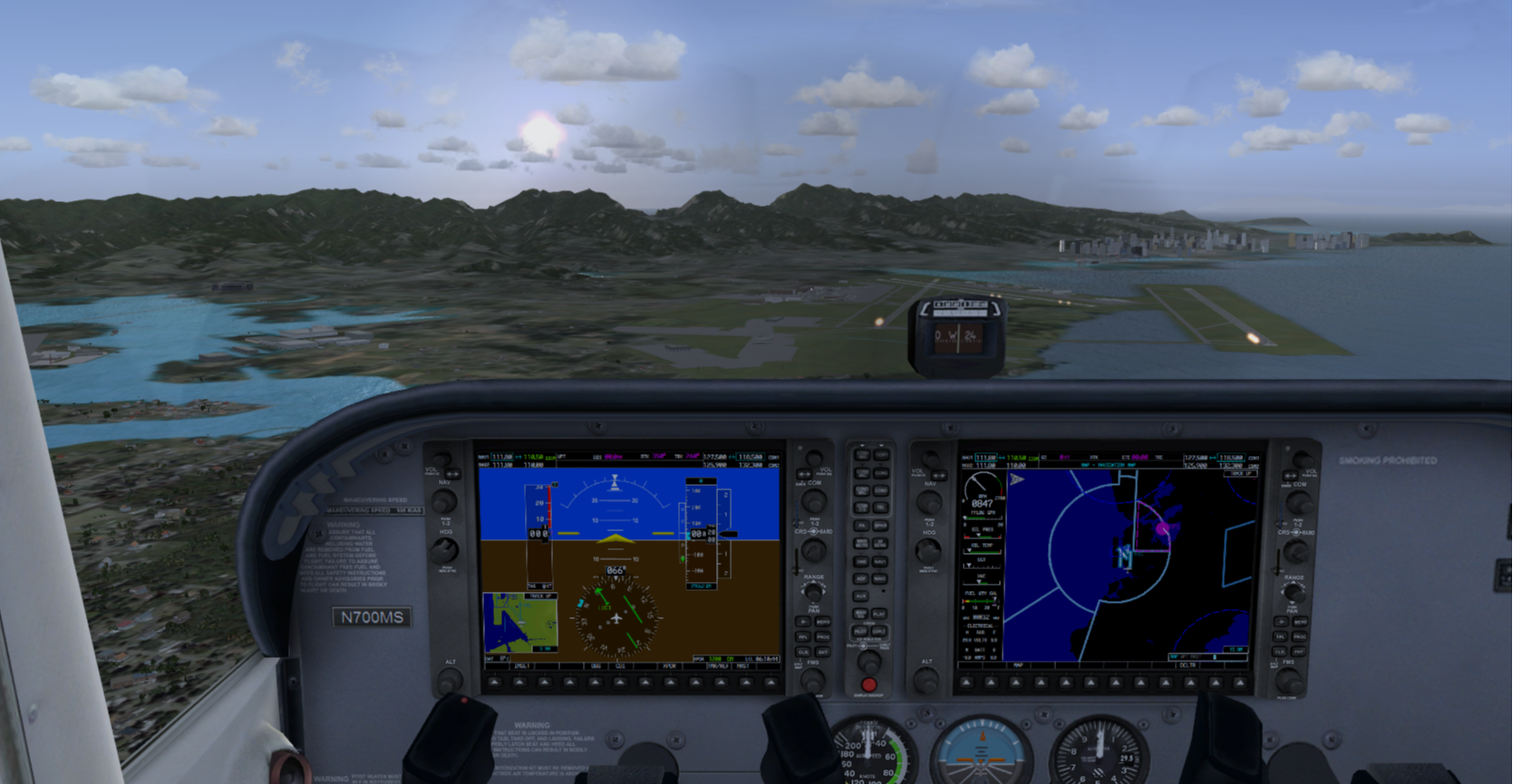
So, you still need to use other best practices to orient yourself quickly. Glass cockpits make the process easier, as the software provides flight path overlays that display what to do. One tip that never fails is to align the course deflection indicator (CDI) with the assigned or planned runway and orient yourself with that in mind.
When I’ve shown this to students in flight, I’ve seen their eyes light up from what they realize is a sizable workload relief that quickly improves decision-making and situational awareness. It sure beats holding up an airport diagram and spinning it north to figure out where you are, a practice you may have learned in your training.
Familiarity during the taxi
Finally, it's best if you have a plan for what to do on the ground. Pilots, myself included, have made silly mistakes after landing and trying to expedite the taxi to the FBO by not figuring out the lay of the land.
You should be familiar with NOTAMs and anything pertinent to the day of the flight, as well as the hot spots, taxi signs, markings, and other airport norms. To do this ahead of time, you can use Google Earth again to see how things should progress.
It helps if you also understand how the airport taxiways are oriented, as they usually flow in a particular order (north to south or east to west). Once you land on a runway, in a typical scenario, there are only so many strategic routes that ATC might use to direct you to an FBO.
Even with all the helpful information at your fingertips, don’t forget about the knowledge and expertise offered by aviation professionals and your fellow pilots. If an airport has best practices, you can reach out to pilots or call the tower beforehand to ask what to expect. It will save you a world of confusion.
These best practices have saved me time and time again, especially when flying solo. They are even more helpful if you do not fly often. Forming good habits provides you with a dependable system to keep you safe.
Share this
-1.jpeg)
The Anatomy of a Perfect S-turn

The Top 3 Ways to Finish Flight School Fast